Earth Images Satellite Collection
The Earth Images Collection globes and maps were created using the Satellite Imagemap, a highly realistic image of the surface of the entire Earth. Derived from images taken in the 1980s and 1990s, the Satellite Imagemap represents an accurate and detailed portrait of our world at the end of the twentieth century. More than 30 gigabytes of data from three satellite systems were combined with digital map and terrain data to produce the high resolution natural colour Satellite Images to create this images collection of over 1200 images.
Each collection style is based on a perspective of the globe at 22.5° intervals - by latitude, 90° North, 67.5° North, 45° North, 22.5° North, Equator, 22.5° South, 45° South, 67.5° South, and 90° South giving 9 parallel viewpoints. By Longitude, starting at the prime meridian Greenwich 0°, increment by 22.5°, 22.5° West, 45° West, 67.5° West, 90° West, 112.5° West, 135° West, 167.5° West, International Date Line 180°, 167.5° East, 135° East, 112.5° East, 90° East, 67.5° East, 45° East, 22.5° East giving 16 meridional views. Each of the 144 views has four styles with 2 different white or black backgrounds.
 |
 |
 |
 |
Click on globes above to see the full 144 images covering the globe in that style. |
|||
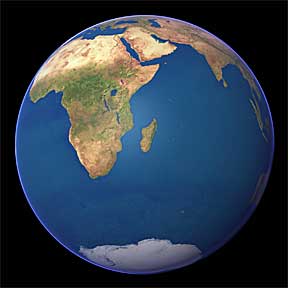
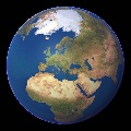
Cloud Free The Earth as it would appear from space if there were no clouds. |
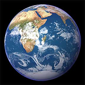
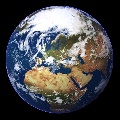
Cloudy The Earth in its natural, cloudy, state. Cloud cover is derived satellite images. |
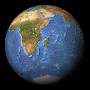
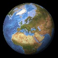
Ocean Depth A natural land suface combined with a colour-coded ocean depth map. |
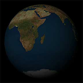
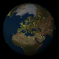
Night-time* The Earth at night without clouds, based on images from the USAF weather satellite. |
Standard cloud free variety has been enhanced via a custom ray tracing program to simulate the normal atmospheric haze while the cloudy version shows our natural planet through data derived from geostationary weather satellites. Ocean depths images have a natural land surface combined with a color-coded ocean depth map and there's also a set of night time images courtesy of USAF Defense Meteorological Satellite Program weather satellites.
Aside from the main images the package offers views showing each continent - Europe, North America, South America, Africa, Asia and Australia - by day and night plus nine stretched out world maps, composed in three sets of world focal viwpoints: Europe, Americas and Pacific azimuth.
The Earth Images Collection is available by immediate download. The retail price is $49.00 for the entire collection, 1179 total images and maps. To download the Earth Images Collection for immediate digital delivery click here.
The digital images are licensed to an individual or a single organisation for print and multimedia publishing, including use on the web. The Satellite Imagemap and other datasets are available for 3D graphics use in video, film and broadcast television.